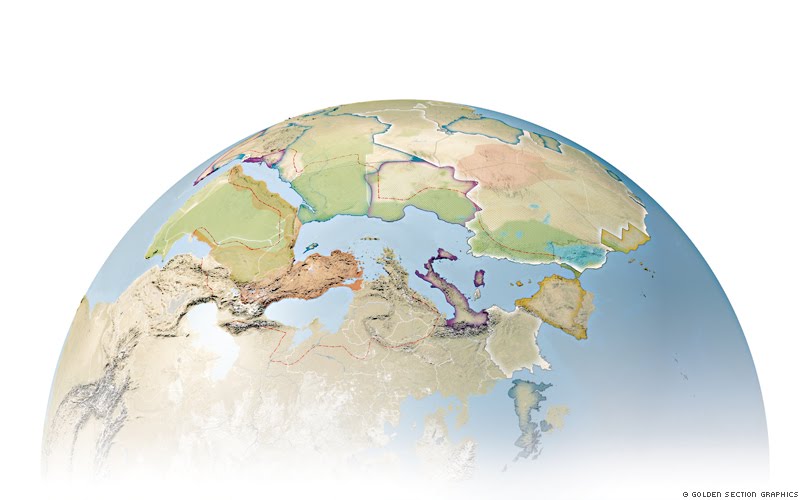
Unsere Karte (3D-Weltkugel), die wir im Auftrage des Politik-ressorts der ZEIT hergestellt haben, zeigt die Situation in Nordafrika und Arabien um 1914 zu Zeiten der Kolonialmächte. Dargestellt sind die Grenzen von Frankreich, Italien, Spanien und Großbritannien, sowie das Osmanische Reich. Zusätzlich zeigen wir die unterschieldichen Stämme und Völker der Region, die heutigen Staatsgrenzen und das Osmanische Reich in seiner größten Ausdehnung.//Our map (a 3-D globe) shows the situation in North Africa and Arabia around 1914, the time of colonial powers. It depicts the Borders of France, Italy, Spain and Great Britain, as well as the Ottoman Empire. Additionally, you can see the territories of the different tribes and peoples of that region, today’s political borders and the Ottoman Empire in its largest expanse.
more information and images: http://www.golden-section-graphics.com/at_last_unowned/